Arkansas Traveler writes on Buffalo River Float Trips

Float Trips Aren’t Just for Spring

By Phil Elliot September 25, 2013

As we switch into the autumn season outdoor activities are inevitably going to change, but they may not have to as soon as one might think. Kayaking and canoeing are two great ways to enjoy the outdoors. even in the later months of the year.

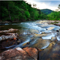
For those who enjoy kayaking or canoeing, Northwest Arkansas area and surrounding areas have many rivers that are well known for their floating. The Buffalo National River in Ponca is a great place to go if you are looking for a nice relaxing float with some friends or family.

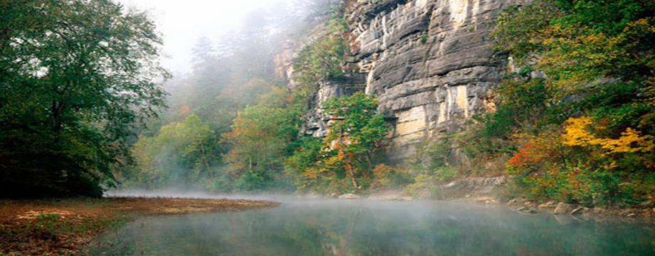
According to buffaloriver.com, the most popular day trip for people to take is 10-mile trip from Ponca to Kyle’s Landing. This is a very scenic float, having wilderness on one side and sheer rock walls on the other, as well as a relatively easy float. It takes no more than six hours. If you are looking for a long weekend trip, the Buffalo has a 26-mile float from Ponca to Pruitt. This trip is still an easy float as far as rapids go, but the overall distance makes it at minimum a two-day adventure.

Read more at the Arkansas Traveler Online
http://www.uatrav.com/2013/09/25/float-trips-arent-just-for-spring/

Categories: History | Leave a comment

Buffalo National River caves – temporarily closed

Buffalo River News Alert

To help stop the spread of the Geomyces sp. fungus suspected to be the causative agent of White Nose Syndrome which is fatal to bats, all Buffalo National River caves are closed to recreational caving until further notice with the exception of the following:

The caves in Lost Valley from Eden Falls Cave to the Lost Valley Campground parking area are open to unrestricted recreational caving. This list of open caves consists of Eden Falls Cave, Lost Valley Natural Bridge, Cob Cave, and Natural Bridge Cave.

Read the rest of the story in the Harrison Daily Times at
http://harrisondaily.com/special_sections/visitors_guide/bnr-closes-caves-to-protect-bats/article_b4edfdc2-2150-11e3-b1be-001a4bcf887a.html

Categories: History | Leave a comment

American Airlines In-flight magazine features Buffalo National River

Many thanks to Bob Whitby for his article

Arkansas’ BUFFALO NATIONAL RIVER is one of the country’s last undammed rivers and a great American treasure.

I was maybe a mile into my first hike along the bluffs that surround and define the Buffalo National River when I turned to look back up the trail I’d just come down, noticing how it zigzagged up rock steps, through slippery mud, between two twisted oak trees and out of sight. Perhaps I’d been a little too dismissive of the terrain.

Read More at   http://hub.aa.com/en/aw/buffalo-national-river-arkansas


Categories: History | Leave a comment

Buffalo River Celebrates 40th Anniversary.

In 1972, a historic battle for the Buffalo River ended with the creation of America’s First National River. A beautiful, free flowing stream that exists because many committed citizens believed its value was in its natural state. buffalo river

“It is simply that the Buffalo National River and its surrounding natural landscape can be our sanctuary, a refuge – at least from time to time – for physocal, mental, and spiritual renewal. A place to be enjoyed, cherished, treasured, and defended. Get to know this river, get informed about anything threatening its integrity, and then do whatever you can to protect and improve it. But work to protect Nature and her gifts, anywhere you can.”

-Ken Smith

Categories: History | Leave a comment

The Buffalo River Trail- Hiking Boxley to Ponca

The Buffalo River Trail (BRT) is a 36.5 mile trail located in the Upper Buffalo section. The BRT tracks the Buffalo National River. It can be completed at once or in sections. The South Boxley to Ponca Section (11 miles) is covered here. Much of the trail is blazed with white and BRT signs but special attention should be paid as the trail becomes less visible after Running Creek.

buffalo river trail hiking

Photo of Whiteley homestead taken by renowed landscape photographer Edward C. Robison III.

Harrison, Arkansas is the nearest city center to the Upper River and many people begin their trip from here. From the Gateway City of Harrison, take Scenic Hwy 7 South out of town. Turn right onto Hwy 43. The road takes you through the Boxley Valley where elk graze against the backdrop of tree covered mountains. At Hwy 21 turn right and continue south. Be sure and take note of the beautifully preserved Boxley church on the right. As the road climbs out of the valley, turn off to the right at the South Boxley Trailhead. Overnight parking is allowed and the BRT begins here.

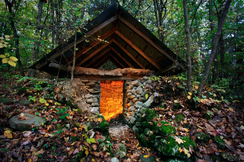
Right away you will see the original Whiteley homestead with the root cellar and chimney still visible.  The Whiteley Cemetery sits above the parking area and is worth the extra little hike before starting out on the BRT. A National Park Kiosk adjacent to the parking area lists trail details.

buffalo river cemetery

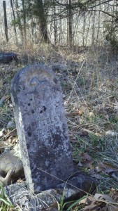
Headstone in the Whiteley Cemetery located in the Buffalo River National Park Region. Photo taken by local hiker.

To begin, cross the highway and follow the signs for BRT. This section of the BRT was built in 1994 by volunteers including groups from the Ozark Society, the American Hiking Society and the Sierra Club to name a few. Fairly soon the trail becomes quite steep. The climb is worth it and soon the trail will open up to some breathtaking views. Locust trees, stands of beech, moss covered boulders and clear running streams accompany you along this 11 mile section of the Buffalo River Trail.

Mileage

Trailhead to County Road 25       1.7 miles
County Road 25 to Arrington Creek        1.6 miles
Arrington Creek to Dry Creek        4.3 miles
Dry Creek to Running Creek       0.6 miles
Running Creek to Sinkholes       2.1 miles
Sinkholes to Ponca Low Water Bridge       0.7 miles

Known as the Gateway to the National Park Region, Harrison offers a variety of shopping and accommodations. From big box stores to locally owned natural food stores, Harrison is also home to well-known and independently owned lodging. If you traveling from out of town, you may want to consider staying overnight in Harrison while you prepare for your trip. Shuttles to and from Harrison are offered by the Hotel Seville. Other hotels may offer shuttle service as well. Guidebooks detailing the trail are available. “Buffalo River Hiking Trails,” written by local photographer and outdoor enthusiast Tim Ernst, are recommended.

Categories: Gateway to the National Park, Hiking, History | Tags: , , , , | Leave a comment

Buffalo River History

The Buffalo River’s history as America’s First National River began in 1972 but the history of the river began long before that.

The Buffalo River National Park Region began forming hundreds of millions of years ago. During the Paleozoic Era, sediments were deposited that would eventually form the bedrock for the region. The oldest rock visible near the Buffalo was deposited about 480 million years ago and 300 million years ago the youngest rock, found on the highest mountaintops, was deposited. Erosion over millions of years formed the valleys and revealed the layers of rock, fossils and impressions of extinct marine life that are visible today.
buffalo river history

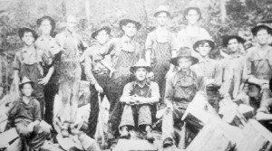
Young men at a logging camp located near the upper Buffalo River around 1920. Photo credit: Buffalo River Handbook by Kenneth L. Smith.

Living on the Buffalo

Evidence suggests prehistoric Native Americans were living near the Buffalo River around 9500 BC. Hunters and foragers, they lived in small groups until about 3000 BC. Their unique chipped stone points have been found all around the Ozarks and in the Buffalo River’s watershed. Sometime after 3000 BC, these small groups began building homes and settling in. Camps near Erbie and Rush, discovered in the 1980’s, reveal conical shaped homes, clay plaster, pottery fragments and animal and plant remains. Around 900 AD, Native Americans began to rely more on cultivated crops and became more sedentary. Evidence of camps discovered near Rush and in Boxley Valley showed maize (small corn), rectangular structures, fishing kitchen refuse and storage pits, and small points made for arrows called “bird points.”

From 1500 to 1700, there is no archaeological record of people occupying the area. Tree ring data show that the Ozarks suffered a prolonged drought between 1560 and 1590 which may have made it difficult for people to live in the area.

In the 1700’s the Osage Indians hunted the lands of the Buffalo River Region and by 1818, the Osage had given their lands over to the U.S. government. The area was set aside for the Cherokee Indians who were thought to have established a settlement called Sequatchie on the lower Buffalo. By 1828, Native Americans were moved to present day Oklahoma and Europeans began to hunt, trap and settle the area moving up the White River. A land grant in 1793 records the area as Cibolo (Spanish for American buffalo) providing the first recorded time the area was named Buffalo. Few settlers in the early 1800’s filed for title to land. Many were poor or just moving through the area on their way to someplace else. By 1860, around 8000 people lived in the Buffalo River area.

Civil War in the Ozarks

During the Civil War era the Buffalo River Valley was split with sympathizers to both Union and Confederate cause. Caves in the Buffalo River area were controlled by the Confederate army from 1861-1862. Control of the caves meant they could harvest bat guano which was an important ingredient used to make gunpowder. By 1863, the area became a safehaven for bushwhackers and deserters due to the rugged terrain. During this time, many of the homesteaders who occupied the area moved to avoid danger until the war’s end.

Living Off of the Land

Families who had acquired land in the Buffalo River region had to work hard to make it. The land provided plenty of food but it was difficult for those families to make money. Many farm families grew cotton and some harvested pharmaceutical plants like goldenseal, genseng, sassafras and slippery elm to sell to dealers. Mining yeilded lead and zinc ore and was a lucrative business from 1890-1918. Following World War I, mining towns began their decline. What remains of the most productive zinc mine in northern Arkansas can be seen at Rush Creek. While ore could not be productively transported by the Buffalo, timber could. Cedar logging took place all over Newton County with crews cutting all winter and shipping logs down the river in the spring. Many of those logs would eventually become Eagle pencils.

During the depression, many families were starved out and from 1930-1960 the areas population continued to fall. It wasnt until better roads, improved industry standards and more sophisticated industrial equipment made the timber business viable again. Today, many of the people living in the Buffalo River region retired to the area or make a modest living catering to recreationists.

Saving the River  

Due to the Buffalo River’s connection to the White River, many proposed  to dam and develop the Buffalo over the years. From transportation of timber to hydroelectric power, the Buffalo River was not appreciated as a free flowing river by the government until the 1960’s. There were many proponents to keep the Buffalo as a free flowing river including well known artist, Thomas Hart Benton. Benton was an annual visitor to the Buffalo in the mid-sixties and wrote to the Corps of Engineers imploring them to, “let the river be.”  In 1972, the National Park Service acquired land along the river and today they protect the park and its resources for the enjoyment of all.

The Buffalo River has witnessed peoples stories and adventures for centuries. Because so many people valued the free flowing Buffalo River, we can enjoy today. Find your adventure on the Buffalo National River.

History of the Buffalo River was taken in part from Buffalo River Handbook written by Kenneth L. Smith.

Categories: History | Tags: , , , | Leave a comment