Controlled Burn in the National Park

FIRE ALERT for Arkansas Spring Break Travel

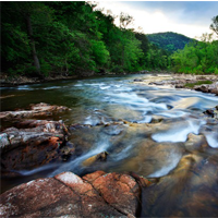
Buffalo National River had a 350-acre controlled burn at Slay Branch in Searcy County which remained contained and controlled according to plan. The majority of the smoke affecting Newton, Searcy, Marion, and Boone counties are attributed to multiple prescribed burns totaling 16,000 acres by the United States Forest Service as well as a number of authorized controlled burns on private property. But volunteer fire departments, Arkansas Forestry Commission, and National Park Service fire crews have been kept busy throughout with smaller burns that have easily gotten out of control with the persistent dry conditions and winds.

The most recent burn threatening Buffalo National River, called the Moore Creek Fire is believed to have started yesterday but was not identified until late in the day as its smoke was cloaked by that of other fires in the area. Very rough topography prevented deployment of assets last night. The current location of the fire straddles Moore Creek, west-northwest of Boxley Church (the church is not threatened). The cause of the fire is unknown. There are three homes and a stationary bus that are threatened by the fire.
There are currently six National Park Service, three Arkansas Forestry Commission (including two dozers), and three Ponca VFD firefighters assigned to the Moore Creek Fire and additional assets have been requested, not only for this blaze, but in anticipation of a generally very busy day. Asset availability is very limited in this part of the state given the number of fires.
Categories: History | Leave a comment

Spring break at the Buffalo

Just when you thought the Winter Warlock would never leave town, he has.  Defrosted and ready to welcome students, families and couples ready for Spring Break is probably the most popular destination in the Arkansas Ozarks, Eureka Springs.  Not only is flora beginning to blossom but area attractions are opening up as well.

“We anticipate this to be our biggest Spring Break in decades,” stated Bill Ott. past chairman of the Greater Eureka Springs Chamber of Commerce.  “Folks in our market area have been held hostage in their  homes much too much this winter by cold, snow and ice.  Cabin fever is at epidemic level and Eureka Springs has the cure.”

“A huge portion of our fever-reducing Rx is the list of area attractions that reopen just in time for these marvelous weeks in March,” Ott explained.  “Everything from ghosts to big cats, from downtown tours to uptown illusions and everything in between will keep “spring breakers” well entertained while being just steps away from Mother Nature’s reawakened living room.”

A partial list of Eureka Springs attractions that will be open during Spring Break 2014 include Crescent Hotel Ghost Tours, Eureka Ghost Tours at Basin Park Hotel, Turpentine Creek Wildlife Refuge, “Hell Raisers, Hoodlums & A Heated History” Walking Tour, Eureka Springs Downtown-N-Underground Tour, Intrigue Theater, and Pig Trail Kart N Golf.  A complete list of open attractions is available by calling the Greater Eureka Springs Chamber of Commerce at 800-638-7352.

“Those ‘big kids’ who really want to unwind during their spring break visit here, will visit one of the many spas that dot the hillsides of this stair-step town,” Ott continued.  “And when optimum relaxation is reached, interest turns to food.  For that, Eureka Springs boasts one of the greatest selections of quality restaurants in the state.”

Unfortunately, some in Arkansas and the surrounding states have had their spring breaks cut a day or two short this year because of make-up snow days.  This means many families will be looking for an exciting destination closer to home so valuable “break” time will not be lost to hours of driving.  Plus, “spring breakers” have said that Eureka Springs is a compact enough community that even a few days can be filled with a week full of activities.

“Our research shows that one of the most popular activities during Spring Break is simply exploring this historic, distinctive destination,” noted Ott.  “Just a few feet off of a busy downtown street will put you on a forested trail that will take you to hidden treasures of a town that time forgot.  Best of all, parents feel safe enough here to allow their older kids a chance to explore on their own when accompanied by a cell phone.”

With the compact spring break season, travelers to Eureka Springs are urged to make their lodging reservations far in advance.  Some attractions, spas and restaurants require advance reservations as well.

Categories: History | Leave a comment

National Geographic: Arkansas Ozarks

For more of the world’s greatest driving tours, get National Geographic’s new book Drives of a Lifetime.

Plan your drive around this celebrated corner of Arkansas for October, and you’ll find yourself immersed in fall colors. Enveloping the twisting roads that interlace the northern part of Arkansas are deciduous forests that, in autumn, create a kaleidoscopic palette of crimsons, saffrons and ochres.
Read More at http://travel.nationalgeographic.com/travel/road-trips/ozarks-arkansas-road-trip/

Categories: History | Leave a comment

Buffalo River – Boxley Mill Open

BOXLEY — The historic Boxley grist mill will be open this weekend, not to farmers wanting to grind corn and wheat, but for inspection by residents and visitors.

The mill has been a landmark in Boxley Valley for more than 100 years.

The National Park Service and Buffalo National River Partners will conduct tours from 10 a.m. – 1 p.m. Saturday, Oct. 26, and Sunday, Oct. 27.

Read the full story at the Harrison Daily TImes

Categories: History | Leave a comment

Junior Ranger Program

Buffalo National River

Learn how to become a Buffalo River Junior Park Ranger Click Here

Categories: History | Leave a comment

Motorcycle Rides in the Ozarks

TWO-WHEELS, TWO-REASONS, TWO SEASONS: A EUREKA SPRINGS MOTORCYCLE ADVENTURE

(EUREKA SPRINGS, AR) — All over the “lower 48”, men and woman who love their motorcycles are marking days off of their calendars as they count down to when they will pull on their leathers, fire up their bikes and start their adventurous ride to the Arkansas Ozarks and one of “America’s Distinctive Destinations”, Eureka Springs.  The reasons are two-fold and it all centers on “pork” …The Pig Trail and Bikes Blues & BBQ.

            The Pig Trail is a not-so-straight ribbon of asphalt; in fact, the ribbon that looks like someone has scraped it across the edge of a scissor blade.  It stretches, for all practical and awesome purposes, from Interstate 40 near Ozark (AR) north along State Highway 23 to Eureka Springs, the gateway to northwest Arkansas.  This 80-mile route is universally praised in motorcycle magazines, on biker websites, and even by The Discovery Channel for being one of the best in America.  For example, MotorycleRoads.com has elevated the Pig Trail to the number eight position in their most recent “top 100” poll.  BikerBudz.com gives it a “highly recommend” while Motorcycle-USA.com refers to it as “my new favorite ride”.  The Discovery Channel has given the Pig Trail its highest mark yet: number two in the nation.

The official National Scenic Byways’ 19-mile portion of the Pig Trail starts as you enter the Ozark National Forest from the south and ends near Brashears (AR) as you exit the national forest to the north.  This route, which crosses both the Mulberry and the White rivers, has so many S-curves that motorcyclists are forced to make dozens of ultra-quick right-to-left-to-right and back again leans; perfect first-gear switchbacks.  But riders should not think the challenge of the ride is limited to “the forest”.  It starts once you exit Interstate 40 heading north and doesn’t end until you put down your kickstand for the night in Eureka Springs.

“The Scenic Byways section of the Pig Trail may be like the most thrilling point in a roller coaster ride,” one biker explained, “but like a roller coaster, the runs on either side (11 miles to the south; 50 miles to the north) are pretty exciting too.  For me, every year between late August and the Hunter’s Moon is when I enjoy the full 80-mile ride.  ‘Cuz if you’re gonna ride the Pig Trail, ya gotta go whole hog.”

“The highway going up to Eureka Springs and all those around that town,” he continued, “are one exhilarating rush.  I hub out of Eureka, a funky, biker-friendly mountain town with lots of places to stay, lots of places to play.  I’ll spend four or five days searching out new Ozark roads with new crazy curves and new breathtaking sights.  It’s like a rally every day.  Plus Eureka’s only about 45 minutes from Fayetteville and the ‘triple-B’, Bikes Blues & BBQ.”

For Bikes Blues & BBQ the aforementioned “whole hog” is dressed, seasoned, grilled till tender, slathered with sauce, and then served up razorback-style when more than 400,000 bikers converge on Fayetteville (AR) for the four fabulous days of this event in September.  This year this awesome fall festival goes from September 18th through the 21st.

“One of the best parts of Bikes Blues & BBQ,” a biker from Central Texas, who has not missed any one of the previous 13 annual events, proudly stated, “is that you don’t just get a festival, you get the Pig Trail and all of its Ozark side-roads.  Me and my group like to arrive a couple days early or stay a couple days late to make sure we have plenty of time for day rides to and around Eureka on their fantastically freaky yellow-striped trails.  We only wish we had routes like this back in Texas.”

To make it easy for those who attend Bikes Blues & BBQ to find new, thrilling nearby routes, both the event and Eureka Springs have online sites for maps and directions: http://www.bikesbluesandbbq.org/rally-info/maps-directions/ and http://www.eurekaspringsmotorcycleroutes.com/ .

If you are unable to attend the “triple-B event” do not despair, because “does Mother Nature have a deal for you” in October and often through early November!  There is no more lovely autumn color than the reds, oranges, golds and violets of the Ozarks when fall falls.  To help you with perfect timing, the State of Arkansas, beginning in September each year, has a “fall color updates” page on their very popular Arkansas.com website.

And speaking of the State of Arkansas, their Department of Parks & Tourism has developed a short movie that will whet your appetite and make you hungry for a motorcycle vacation to “The Natural State”.  It just so happens that a local motorcycle enthusiast who is also the Mayor of Eureka Springs, Morris Pate, narrates the movie.  His narration begins with him and his 2001 Harley-Davidson Electra Glide Classic parked in front of the “Little Golden Gate Bridge” just a few minutes west from downtown Eureka.

“The Beaver Bridge is a landmark that must not be missed,” bragged Mayor Pate.  “This beautiful old wooden suspension bridge was built in 1949 and is 554 feet long, only 11 feet wide and has been painted a bright yellow.  Because it is so narrow, traffic can only move one way at a time across the span.  So hold your breath and grip tight, this is one bumpy and thrilling ride on two wheels.”

So whether you ride the Ozarks in late summer, late fall or anytime in between, you will be glad you did.  “No matter how many other motorcycle routes you’ve been on,” concluded our Texas biker, “once you’ve conquered the Pig Trail and its web of side-roads, you’ll be happier than a hog in slop.”

Special packages just for bikers can be found at numerous web sites, such as EurekaSpringsMotorcycleRoutes.com and Arkansas.com/deals-coupons

Categories: History | Leave a comment

Buffalo River Float Trips

Float Trips Aren’t Just for Spring

By Phil Elliot September 25, 2013

As we switch into the autumn season outdoor activities are inevitably going to change, but they may not have to as soon as one might think. Kayaking and canoeing are two great ways to enjoy the outdoors. even in the later months of the year.

For those who enjoy kayaking or canoeing, Northwest Arkansas area and surrounding areas have many rivers that are well known for their floating. The Buffalo National River in Ponca is a great place to go if you are looking for a nice relaxing float with some friends or family.

According to buffaloriver.com, the most popular day trip for people to take is 10-mile trip from Ponca to Kyle’s Landing. This is a very scenic float, having wilderness on one side and sheer rock walls on the other, as well as a relatively easy float. It takes no more than six hours. If you are looking for a long weekend trip, the Buffalo has a 26-mile float from Ponca to Pruitt. This trip is still an easy float as far as rapids go, but the overall distance makes it at minimum a two-day adventure.

Read more at the Arkansas Traveler Online
http://www.uatrav.com/2013/09/25/float-trips-arent-just-for-spring/

Categories: History | Leave a comment

American Airlines features Buffalo National River

Many thanks to Bob Whitby for his article

Arkansas’ BUFFALO NATIONAL RIVER is one of the country’s last undammed rivers and a great American treasure.

I was maybe a mile into my first hike along the bluffs that surround and define the Buffalo National River when I turned to look back up the trail I’d just come down, noticing how it zigzagged up rock steps, through slippery mud, between two twisted oak trees and out of sight. Perhaps I’d been a little too dismissive of the terrain.

Read More at   http://hub.aa.com/en/aw/buffalo-national-river-arkansas


Categories: History | Leave a comment

Buffalo River 40th Anniversary.

In 1972, a historic battle for the Buffalo River ended with the creation of America’s First National River. A beautiful, free flowing stream that exists because many committed citizens believed its value was in its natural state. buffalo river

“It is simply that the Buffalo National River and its surrounding natural landscape can be our sanctuary, a refuge – at least from time to time – for physocal, mental, and spiritual renewal. A place to be enjoyed, cherished, treasured, and defended. Get to know this river, get informed about anything threatening its integrity, and then do whatever you can to protect and improve it. But work to protect Nature and her gifts, anywhere you can.”

-Ken Smith

Categories: History | Leave a comment

Buffalo River Trail – Boxley to Ponca

The Buffalo River Trail (BRT) is a 36.5 mile trail located in the Upper Buffalo section. The BRT tracks the Buffalo National River. It can be completed at once or in sections. The South Boxley to Ponca Section (11 miles) is covered here. Much of the trail is blazed with white and BRT signs but special attention should be paid as the trail becomes less visible after Running Creek.

buffalo river trail hiking

Photo of Whiteley homestead taken by renowed landscape photographer Edward C. Robison III.

Harrison, Arkansas is the nearest city center to the Upper River and many people begin their trip from here. From the Gateway City of Harrison, take Scenic Hwy 7 South out of town. Turn right onto Hwy 43. The road takes you through the Boxley Valley where elk graze against the backdrop of tree covered mountains. At Hwy 21 turn right and continue south. Be sure and take note of the beautifully preserved Boxley church on the right. As the road climbs out of the valley, turn off to the right at the South Boxley Trailhead. Overnight parking is allowed and the BRT begins here.

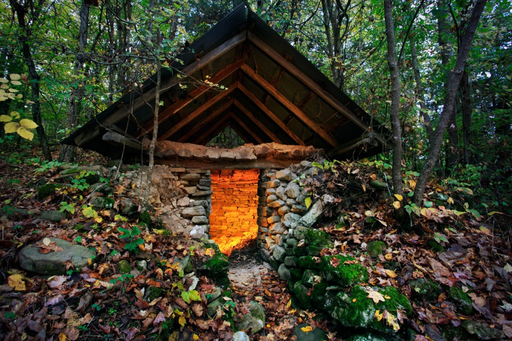
Right away you will see the original Whiteley homestead with the root cellar and chimney still visible.  The Whiteley Cemetery sits above the parking area and is worth the extra little hike before starting out on the BRT. A National Park Kiosk adjacent to the parking area lists trail details.

buffalo river cemetery

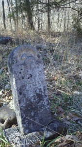
Headstone in the Whiteley Cemetery located in the Buffalo River National Park Region. Photo taken by local hiker.

To begin, cross the highway and follow the signs for BRT. This section of the BRT was built in 1994 by volunteers including groups from the Ozark Society, the American Hiking Society and the Sierra Club to name a few. Fairly soon the trail becomes quite steep. The climb is worth it and soon the trail will open up to some breathtaking views. Locust trees, stands of beech, moss covered boulders and clear running streams accompany you along this 11 mile section of the Buffalo River Trail.

Mileage

Trailhead to County Road 25       1.7 miles
County Road 25 to Arrington Creek        1.6 miles
Arrington Creek to Dry Creek        4.3 miles
Dry Creek to Running Creek       0.6 miles
Running Creek to Sinkholes       2.1 miles
Sinkholes to Ponca Low Water Bridge       0.7 miles

Known as the Gateway to the National Park Region, Harrison offers a variety of shopping and accommodations. From big box stores to locally owned natural food stores, Harrison is also home to well-known and independently owned lodging. If you traveling from out of town, you may want to consider staying overnight in Harrison while you prepare for your trip. Shuttles to and from Harrison are offered by the Hotel Seville. Other hotels may offer shuttle service as well. Guidebooks detailing the trail are available. “Buffalo River Hiking Trails,” written by local photographer and outdoor enthusiast Tim Ernst, are recommended.

Categories: Gateway to the National Park, Hiking, History | Tags: , , , , | Leave a comment